Functions GIS
 |
| Functions GIS |
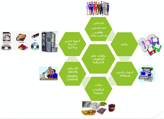
One of the most important components of GIS is people, they are the ones who have to create and develop geographic databases, so there are many jobs so that each person has a job that is specialized in him and the distribution of jobs is one of the most important duties of a GIS manager.
These jobs start from the stage of field survey and data collection, and then preparing a geographical database for analysis, maps and reports output, to help decision-makers take appropriate decisions in many areas, such as saving time and effort to access data through digitization and data entry, map output. Required in supporting decisions and choosing the best places (spatial suitability), and many other examples.
Therefore, any institution, company, or government ministry that has a general administration, department, or GIS department that contains a group of employees, jobs are divided for each person with different specializations as follows:
1. Spatial Data Entry:
It is the person who collects, preserves and stores geospatial data within a geographical database, the nature of the work through field survey and then the office or receiving data to be managed and maintained for the purpose of storage and digitization within a geographical database.
2. Data Analyst:
He is a person who is more specialized in GIS than data entry in terms of understanding and studying data within any geographical database in a professional manner to support the methods and methods of entering geographical data to shed light on spatial problems to find solutions to them, and then uses the tools of geoprocessors and analysis through modeling Creating a ModelBuilder and designing the necessary work mechanisms to perform the required analyzes, in addition to using advanced GIS extensions to help decision makers take appropriate decisions.
3. Mapping:
A person with all the experience to qualify him in understanding all the requirements of the organization to support their decisions through his production of auxiliary maps, in addition to receiving all the outputs of data analysis to produce maps sourced from the data analyst, all of these maps are subject to standards and rules to improve the map that are set by all specialists.
4. Remote Sensing Specialist:
Someone who is very interested in satellite and aerial images and has the ability to deal with any type of raster data,
Through his specialization and interest in this field, images are prepared, processed, interpreted and analyzed, in addition to making a comparison between images through the time period.
5. GIS Developer:
He is the person responsible for developing programs, work mechanisms, maintenance and applications used in computer programs through work follow-up processes and employee training, in addition to developing the technical staff to become qualified to work.
6. Geodatabase Administrator:
One of the most important responsibilities of this person is to take logical methods and methods and control data quality to manage any geographic database by setting action plans from collection, preservation and storage operations to analysis processes and then producing maps and reports to help decision makers, in addition to granting employees permission to use GIS programs from inside or outside the department.
7. Data View Developer web:
A person responsible for displaying the ready-made geo-database data on the Internet, so that this data can be browsed by the general public with the aim of promoting the institution and displaying its data for many goals.
8. GIS Developer for Smart Devices:
A person responsible for developing applications for smart devices to create applications that help collect data in the field that aims to save time and effort and improve the capabilities of GIS programs at the data collection site.
9. GIS Manager:
A person who has a clear geographical vision about the role of GIS in the organization, company or workplace to benefit from the applications of GIS in supporting and assisting decision-makers in making the appropriate decision to solve problems and develop the institution and its progress, in addition to coordinating all GIS employees in all their functions.
10. Geographical Information Systems Consultant (GIS):
A person with great experience and a high degree in the science of geographic information systems and its techniques and the power of programs, his role in providing the work team with ideas and experiences necessary for development, in addition to holding meetings with external and internal parties and discussing the outputs of GIS in the organization with decision-makers.
These are the most important employee jobs in GIS that are developed according to any organization’s plan, so job titles can differ between one organization and another. These jobs are flexible in the sense that a person can do more than one job and distribute tasks and jobs depending on the manager who distributes the job in relation to work requirements .
In addition, it is recommended to read articles on GIS.

Comments
Post a Comment